NBC News logo
BBC News logo
CBN logo
18 articles
·6d

Category 5 Hurricane Erin Prompts Mandatory Evacuations for Outer Banks

Category 5 Hurricane Erin, 2025's first, approaches the U.S. coast, prompting mandatory evacuations for North Carolina's Outer Banks amid severe threats.

Overview

A summary of the key points of this story verified across multiple sources.

  • Hurricane Erin, the first of the 2025 Atlantic season, has rapidly intensified to a Category 5 storm, posing a significant threat as it moves north-northwest towards the U.S. coast.
  • Mandatory evacuation orders are now in effect for Hatteras and Ocracoke islands in North Carolina's Outer Banks due to the severe threat posed by the approaching Category 5 hurricane.
  • Tropical storm and storm surge warnings are active for the Outer Banks, with officials urging residents to evacuate promptly before Highway 12 becomes impassable, isolating communities.
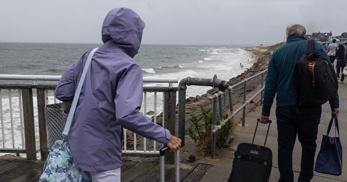
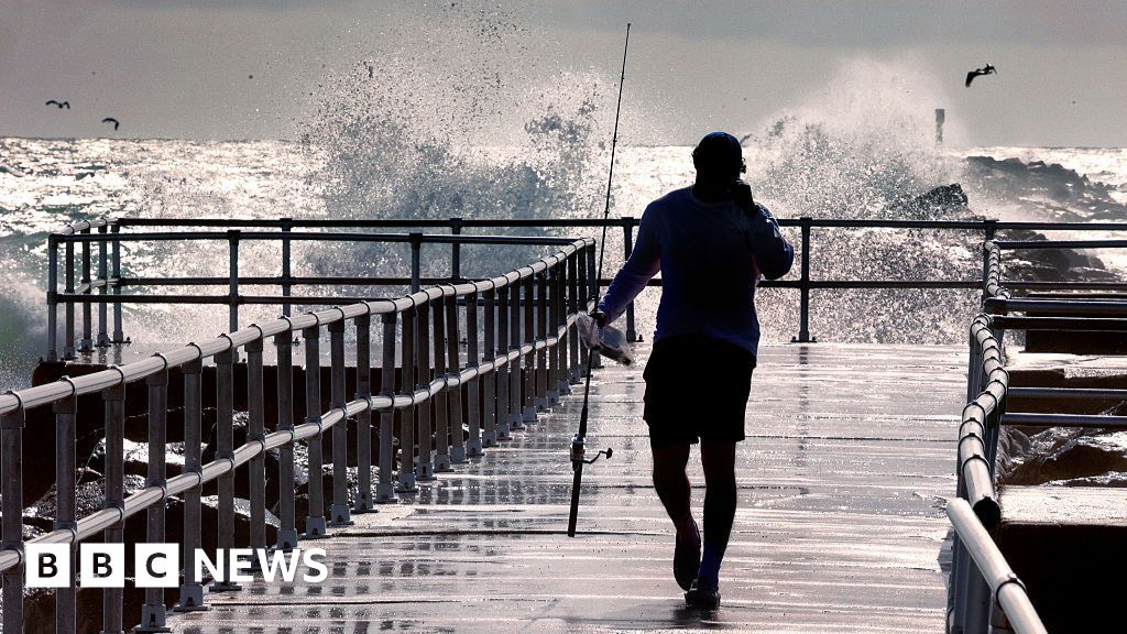
  • Dangerous ocean conditions, including deadly rip currents and high surf up to 20 feet, are anticipated along the entire East Coast, stretching from North Carolina to Long Island.
  • Authorities warn that Hurricane Erin could inundate Highway 12, potentially isolating Outer Banks communities for an extended period due to road closures and impassable conditions.
Written by AI using shared reports from
18 articles
.

Report issue

Pano Newsletter

Read both sides in 5 minutes each day

Analysis

Compare how each side frames the story — including which facts they emphasize or leave out.

Center-leaning sources cover Hurricane Erin neutrally, focusing on factual updates, official warnings, and the storm's anticipated and current impacts. They prioritize public safety information, including forecasts, road closures, and evacuation orders, without employing loaded language or selective emphasis. The reporting is direct and informative, adhering to standard disaster coverage practices.

"Dangerous rip currents and coastal flooding will remain threats in the area into early Saturday."

NBC NewsNBC News
·6d
Article

"Life-threatening rip currents and other dangers brought to the US east coast by nearby Hurricane Erin will last for at least a couple more days, officials say, as the storm heads north."

BBC NewsBBC News
·6d
Article

"Hurricane Erin reached its closest approach to the U.S. East Coast and was just beginning to move away from North Carolina early on Aug. 21, but was still unleashing powerful waves and rip currents, threatening beachfront homes and flooding roads as authorities urged people to stay out of the water."

USA TODAYUSA TODAY
·6d
Article

"Swimmers are warned to avoid beaches along the East Coast as Hurricane Erin moves north and slams much of the shoreline with dangerous waves and other severe weather."

NPRNPR
·7d
Article

"Authorities have ordered mandatory evacuations of Hatteras and Ocracoke amid fears that the main highway linking them to other islands could become impassable."

BBC NewsBBC News
·7d
Article

"Hurricane Erin is creating potentially deadly water conditions all along the U.S. East Coast days before the largest waves are expected, with high winds and waves anticipated in North Carolina by Wednesday night."

ABC NewsABC News
·7d
Article

"A tropical storm warning has been issued for North Carolina as Hurricane Erin churns up the east coast of the U.S. as a Category 2 storm."

NBC NewsNBC News
·7d
Article

"Hurricane Erin, now a Category 2 storm, has triggered a state of emergency in North Carolina, where residents and visitors along the Outer Banks are under evacuation orders."

ABC NewsABC News
·7d
Article

"Hurricane Erin continues to spin in the Atlantic and is forecast to grow even larger, with weather conditions expected to deteriorate along the coast of North Carolina and forecasters urging caution against swimming at most East Coast beaches."

USA TODAYUSA TODAY
·7d
Article

"Beachfront property owners are bracing for the worst with predictions for a life-threatening storm surge of up to 4 feet and significant coastal erosion, with "large, powerful, life-threatening" waves of 15 to 20 feet expected to batter beaches, especially in North Carolina, for 48 hours or more as the hurricane crawls northward offshore through at least Aug. 21, if not longer."

USA TODAYUSA TODAY
·7d
Article

"The storm's massive size, rather than its windspeeds, is what makes it a threat."

NPRNPR
·8d
Article

"Evacuations were ordered on barrier islands along the Carolina coast as authorities warned the storm could churn up dangerous rip currents from Florida through the Mid-Atlantic to the New England coast."

CBS NewsCBS News
·8d
Article

Articles (18)

Compare how different news outlets are covering this story.

FAQ

Dig deeper on this story with frequently asked questions.

Mandatory evacuation orders are in effect for Hatteras and Ocracoke islands in North Carolina's Outer Banks.

Highway 12 on Hatteras Island is expected to become impassable for several days due to flooding and inundation, potentially isolating Outer Banks communities.

Large breaking waves of 15-20-plus feet, life-threatening swimming and surfing conditions, and significant beach erosion are expected from North Carolina to Long Island.

Hurricane Erin may not make direct landfall but is still expected to bring dangerous and destructive impacts along the East Coast.

Local authorities have declared a State of Emergency, issued mandatory evacuations, and closed beach accesses and facilities at Cape Hatteras National Seashore.

History

See how this story has evolved over time.

  • 7d
    NPR logo
    The Guardian logo
    BBC News logo
    6 articles
  • 7d
    NBC News logo
    ABC News logo
    USA TODAY logo
    4 articles
  • 8d
    NPR logo
    Daily Caller logo
    CBS News logo
    4 articles