Tropical Storm Erin Rapidly Intensifies, Nears Hurricane Status Threatening Caribbean
Tropical Storm Erin, the 2025 Atlantic season's fifth named storm, is rapidly strengthening with 70 mph winds, posing a significant threat to the Leeward Islands, Virgin Islands, and Puerto Rico, with hurricane status expected.
 New York Sun
Hurricane Erin Strengthens to Dangerous Category 4 Storm but Is Likely To Spare American Mainland
 BBC News
Hurricane Erin rapidly intensifies to category five storm
 The Guardian
Hurricane Erin gathers force as it nears Leeward Islands

 CBS News
Erin becomes a Category 4 hurricane in Caribbean and is expected to get stronger before swerving from continental U.S.
Overview
Tropical Storm Erin, the 2025 Atlantic season's fifth named storm, is rapidly strengthening with 70 mph winds and is forecast to become the season's first hurricane by the weekend.
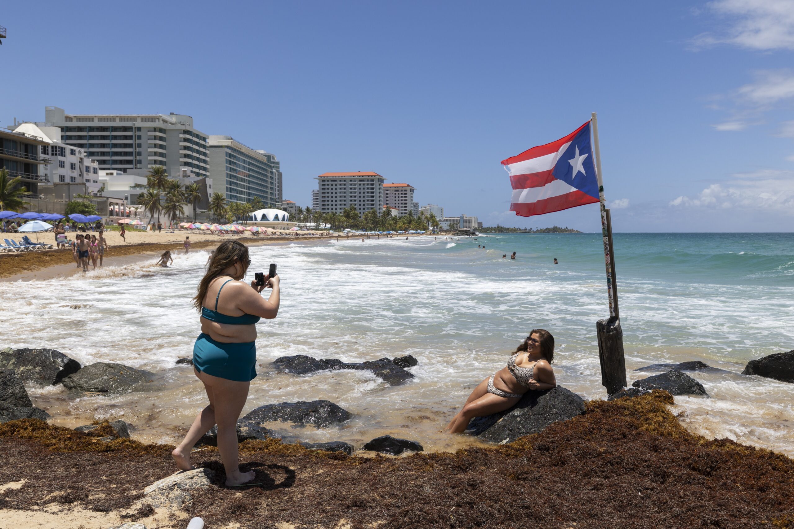
The storm is moving northwest, prompting tropical storm watches for parts of the Leeward Islands, U.S. and British Virgin Islands, and Puerto Rico, indicating immediate danger.
Erin has the potential to reach major hurricane status, urging immediate preparedness in the affected areas as it poses a significant regional threat with its rapid intensification.
The storm is expected to bring 2-4 inches of rain, with isolated areas receiving up to 6 inches, raising significant risks of flash flooding, landslides, and mudslides.
Heavy rains and dangerous surf are anticipated over the weekend in Puerto Rico and the Virgin Islands, with increasing rip current risks in the western Atlantic next week.
Analysis
Center-leaning sources cover Hurricane Erin neutrally, focusing on factual reporting and scientific explanations. They rely heavily on official meteorological data and expert analysis to inform the public about the storm's status, path, and potential impacts, avoiding sensationalism or political commentary.
FAQ
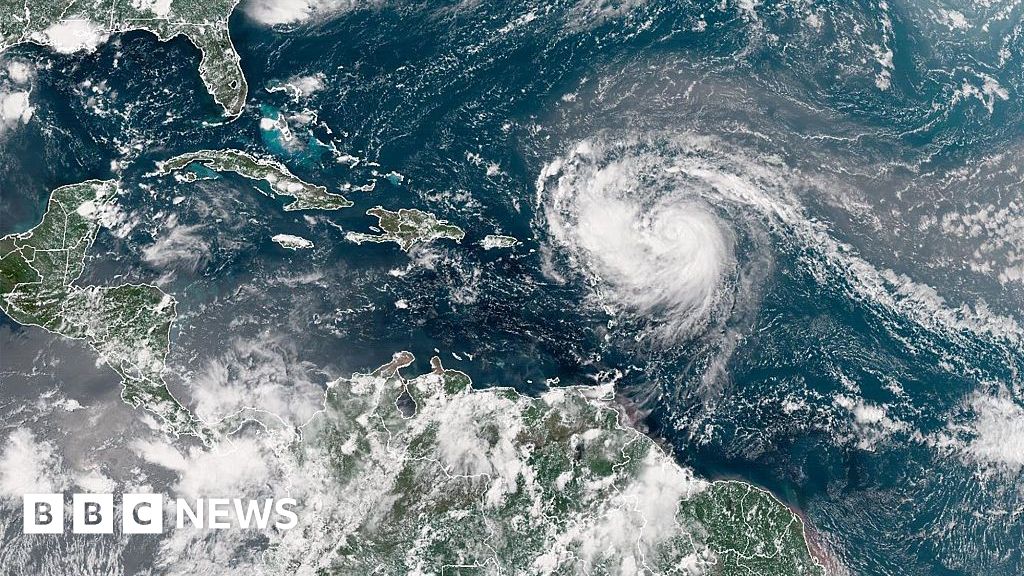
Hurricane Erin has rapidly intensified into a Category 4 hurricane with sustained winds of 155 mph and is expected to possibly reach Category 5 status.
The northern Leeward Islands, U.S. and British Virgin Islands, and Puerto Rico are under tropical storm watches and immediate threat as Hurricane Erin approaches.
The storm is expected to bring heavy rains of 2-4 inches, isolated up to 6 inches, causing flash floods, landslides, mudslides, heavy surf, and increased rip current risks.
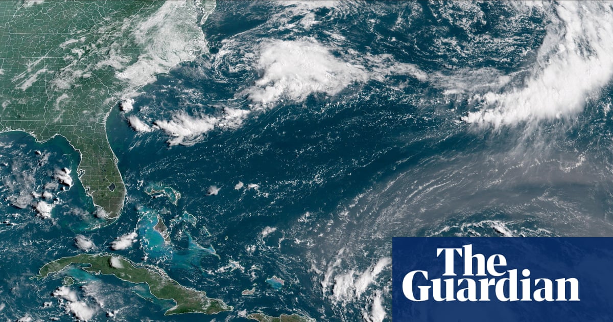
Erin is moving west and is forecast to turn west-northwest and then north early next week, moving just north of the northern Leeward Islands, Virgin Islands, and Puerto Rico over the weekend.
Residents in the threatened areas are urged to prepare immediately due to the storm's rapid intensification and potential to become a major hurricane causing significant regional threats.