Powerful Nor'easter Batters East Coast, Prompts States of Emergency and Widespread Disruptions
A powerful nor'easter batters the East Coast, prompting states of emergency in New Jersey and NYC. Heavy rain, strong winds, and widespread flooding are causing significant disruption.

 USA TODAY
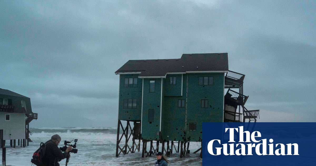
Video shows powerful nor'easter slam homes on North Carolina coast, flood New Jersey

 New York Daily News
Nor’easter batters region for 2nd day with flooding, 60mph wind gusts
 USA TODAY
Nor'easter slams the East Coast as more rain, strong winds are expected
 The Guardian
New Jersey declares state of emergency as nor’easter approaches
Overview
New Jersey and New York City declared states of emergency, effective Saturday night, as a powerful nor'easter began battering the East Coast with severe weather conditions.
The storm brought heavy rain, strong winds exceeding 60mph in coastal New Jersey, and over 50mph in Jersey City, leading to widespread coastal flooding and road closures.
The National Weather Service issued coastal flood warnings and wind advisories for New York City and surrounding areas, anticipating significant impact from the storm's intensity.
The powerful nor'easter caused major disruptions, including the cancellation of New York City's annual Columbus Day Parade and numerous flight delays and cancellations at regional airports.
Utilities deployed over 1,600 additional workers across the affected regions to prepare for and respond to potential power outages and other storm-related issues, ensuring readiness.
Analysis
Center-leaning sources cover this nor'easter story neutrally, focusing on factual reporting of the storm's impact and official responses. They use descriptive language to convey the severity without injecting subjective opinion or political framing, presenting a straightforward account of the weather event across affected regions, allowing readers to form their own conclusions.
FAQ
The most affected areas were New Jersey and New York City, where states of emergency were declared due to heavy rain, strong winds, coastal flooding, and road closures.
The nor'easter brought heavy rain, winds exceeding 60 mph in coastal New Jersey and over 50 mph in Jersey City, leading to widespread coastal flooding and road closures.
The storm caused significant disruptions including the cancellation of New York City's annual Columbus Day Parade and numerous flight delays and cancellations at regional airports.
Utilities deployed over 1,600 additional workers across the affected regions to prepare for and respond to potential power outages and other storm-related issues, ensuring readiness.
The National Weather Service issued coastal flood warnings and wind advisories for New York City and surrounding areas, expecting significant impact from the storm's high intensity.
